
GERULATA-MIROČ

Locality name: Gerulata – Miroč
Name of the project: Limes in Serbia – UNESCO World Cultural Heritage, Research of Miroč – Gerulata fortifications
Research manager: Dr. Bebina Milovanović, senior research associate
Collaborators: Dr. Bojan Popović, scientific associate and MA Ivana Kosanović, professional associate
Institutions involved in the research process: Institute of Archaeology, Belgrade
The Roman site of Gerulata in the village of Miroč on the mountain of the same name, in the territory of the municipality of Majdanpek, includes a small Roman fortification – a castle and a civilian settlement, which protected the road that connected the valley of the Poreč river and the ancient Taliata (Taliata) near Donji Milanovac with the Roman fortification and the town in near today’s Brza Palanka (Egeta). On the Tabula Peutingeriana, it is represented as one of two stations on that road, VIII Roman miles from Taliata. The other was Unam, VI miles from Gerulata. The first mentions of its establishment are by the travel writers F. Kanitz and E. Svoboda. The fortification is visible in the terrain, with partially visible remains of the ramparts on the surface.
The first systematic archaeological excavations are being carried out from July 2021 for nomination to the UNESCO World Cultural Heritage List. The site is on the Preliminary List of UNESCO Frontiers of the Roman Empire (WHS FRE) Serbia (Ref. WHTL-6475) and the excavations should provide the data needed for the final preparation of the nomination file, given that the site has never been excavated so far. The archeological excavations foreseen within the framework of the five-year plan aim to define the dimensions of the fortification, as well as the extent of the vicus and the necropolis.
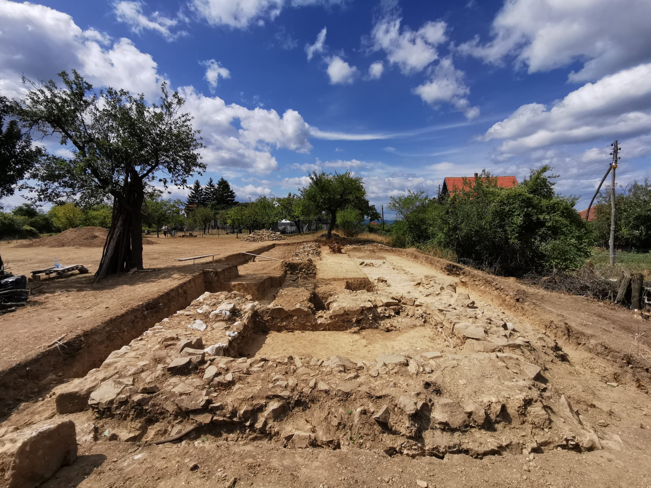
The first geophysical prospecting of the terrain was carried out in 2010 under the leadership of Dr. Sofija Petković in the southern part of the fortification pretenture. On that occasion, a building with a rectangular base was recorded, which is assumed to represent the command building of the castrum (Principia). Subsequent geophysical surveys of the terrain were carried out in 2021 in the northwestern part of the fortification and confirmed the existence of ramparts and smaller buildings next to the rampart.
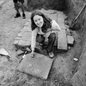
The methodology of the first systematic archaeological research undertaken in 2021 includes a square grid that is positioned on the area of the entire fortification (area of about 2 ha). Based on the configuration of the terrain and the results of geophysical prospecting, excavations were carried out on the part of the northern rampart of the fortification and on the tower next to the northern gate. The total investigated area is 200 m² and includes a part of the northern rampart with a length of 17 m and a tower on the western side of the northern gate. The basic parts of the ramparts have been preserved, while in several places one row of blocks that made up the above-ground construction remained. Parallel to the northern rampart, there is a slightly narrower side of the wall, while the empty space between them had the function of a walkway. The wall inside the rampart, based on preliminary research, could be interpreted as a supporting wall that protected the earth filled with the rampart from being defended. The tower on the western side of the northern gate is also preserved in the foundation zone, while the entrance to the tower is preserved on the southern side. In the following year 2022, research was focused on the area of the western gate (porta principalis sinistra). On this occasion, a part of the western rampart, which was mostly destroyed, and a parallel retaining wall, in the foundation zone, with one or two rows of above-ground construction, were investigated. The northern tower of the western gate was also investigated.
Movable archaeological material from the Roman period (fragments of ceramic and glass vessels, iron rings, bronze coins, stone projectile) roughly belongs to the period from the end of the 1st to the 40s of the 3rd century. So far, only one construction phase has been confirmed, and based on the results so far, it cannot be determined exactly when the fortification was in operation.
Selected Bibliography:
- Kostić Đ., 2011. Dunavski limes Feliksa Kanica. Beograd/Viminacium: Arheološki institut, Centar za nove tehnologije.
- Миловановић Б., Косановић И. и Поповић Б. Систематска истраживања римског утврђења Герулата у селу Мироч током 2022. године, 57, У: Програм, извештаји и апстракти, XLVI Скупштина и годишњи скуп Српског археолошког друштва. 25‒ мај 2023. Сомбор, Србија.
- Milovanović B., Kosanović I. and Popović B. Gerulata – a Fort on the Road From Taliata to Egeta. 6th International Conference on the Danubian Provinces – Roman Roads and Crossroads, Book of Abstracts. 1−5th November 2022, Belgrade and Viminacium, Serbia, 2022.
- Миловановић Б., Косановић И. и Поповић Б. Прва систематска истраживања римског утврђења Герулата у селу Мироч, 77‒78, У: Програм, извештаји и апстракти, XLV Скупштина и годишњи скуп Српског археолошког друштва. 25‒ мај 2022. Прокупље, Србија.
- https://whc.unesco.org/en/tentativelists/6475/


Сарадници

Dr Bebina Milovanović
Senior Research Associate

Dr Bojan Popović
Research Associate